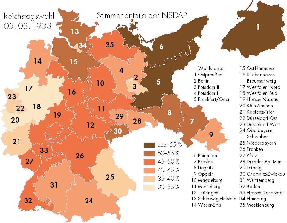
Map of where Germans voted for the Nazis in 1933

In March 1933, a unified Germany held its last relatively free election before WWII. Hitler had already become Chancellor but he held one last election, seeking a mandate under which to rule. This map shows which areas of Germany supported the Nazi Party most strongly.
However, it’s also important to note that while the Nazis won the most seats in 1933, they did not win a majority of them or the popular vote.
Support varied widely across the country. It was highest in the former Prussian territories in the north-east of Germany (with the exception of Berlin) and much weaker in the west and south of the country, which had, up until 1871, been independent German states.
Across Germany as a whole, the Nazis won 43.91% of the popular vote and got 44.51% of the seats. This made them by far the largest party in the German Reichstag, but still without a clear majority mandate.
I know history doesn’t repeat itself, but this sure is rhyming like Kanye.


Stay Connected